Did you know LTSA’s Surveyor General is part of the Alberta-British Columbia Boundary Commission?
The Boundary Commission is comprised of the Surveyor General of Canada Lands, the Director of Surveys of Alberta, and the Surveyor General of British Columbia – and this group is responsible for maintaining the monumentation along the border, often in challenging locations with difficult terrain.
The History of the Alberta – British Columbia Boundary
In 1871, the eastern boundary of British Columbia was the watershed of the Rocky Mountains from the international boundary to the 120th meridian, and then the 120th meridian to the 60th line of latitude.
By 1913, the boundary needed further mapping for communication between the provinces on matters such as coal deposits and forest reserves. The Federal and Provincial governments agreed to survey the boundary, appointing one Commissioner for each jurisdiction of Canada, Alberta, and British Columbia.
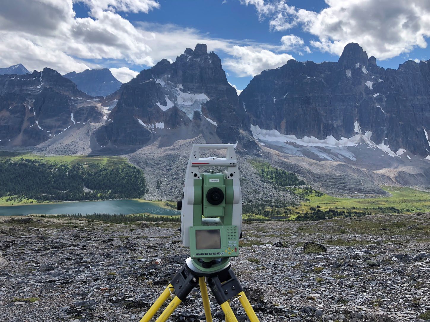
Today, the Boundary Commission has a 30-year Boundary Maintenance Plan to inspect and restore the Alberta – British Columbia boundary monumentation for all surveyed parts of the boundary.
The work of the Boundary Commission was carried out in three phases:
Phase 1 – 1913 to 1924
The Commissioners focused on 13 of the most significant passes. These locations were close to populated areas, mining and timber claims, and highways or railways.
Over the next 12 years, the Commission demarcated – set or defined – the boundaries in the passes and much of the 120th meridian, and mapped the entire watershed boundary. The newly demarcated boundaries were confirmed by the Alberta-British Columbia Boundary Act in 1932.
Phase 2
By 1949, a survey of the boundary along the northern section of the 120th meridian was needed. This work would assist with petroleum exploration and ground control, allowing the mapping of Alberta. From 1950 to 1953, this part of the boundary was fully demarcated and further confirmed by the Alberta-British Columbia Boundary Act in 1955.
In 1955, the prevailing legal opinion was “the Canadian Government’s interest in the matter ceases” once the boundary had been demarcated to the satisfaction of the three jurisdictions. Maintaining the monuments and the cut line (along both the watershed and the meridian) was now a responsibility shared between Alberta and British Columbia.
Phase 3
In 1974, the three jurisdictions agreed a new Boundary Commission should be established. Federal legislation established the Commission – the Alberta-British Columbia Boundary Act, 1974, which remains in force today. The current Boundary Commission has been active since the early 1980’s.
Today, the Boundary Commission has a 30-year Boundary Maintenance Plan to inspect and restore the Alberta – British Columbia boundary monumentation for all surveyed parts of the boundary.
Learn more: For more detail and history on the Boundary Commission, visit the Alberta-British Columbia Boundary Commission page, or learn more about the history of the Surveyor General.