Alberta-British Columbia Boundary Commission
Contents
Attention, cette page est également disponible en français.
Boundary Commissioners
- Alberta – Al Flim, ALS, Director of Surveys
- British Columbia – Cristin Schlossberger, BCLS, Surveyor General
- Canada – Martin Gingras, CLS, QLS, Surveyor General
The Current Alberta – British Columbia Boundary Commission
The current Boundary Commission has been active since the early 1980’s and is comprised of the Surveyor General of Canada Lands, the Director of Surveys of Alberta, and the Surveyor General of British Columbia. The Commission meets semi-annually to carry out its responsibilities, which include: Maintaining the records of the Commission, settling problems or disputes referred to the Commissioners concerning the interprovincial boundary; restoring and maintaining boundary monuments; and managing surveys of the interprovincial boundary.
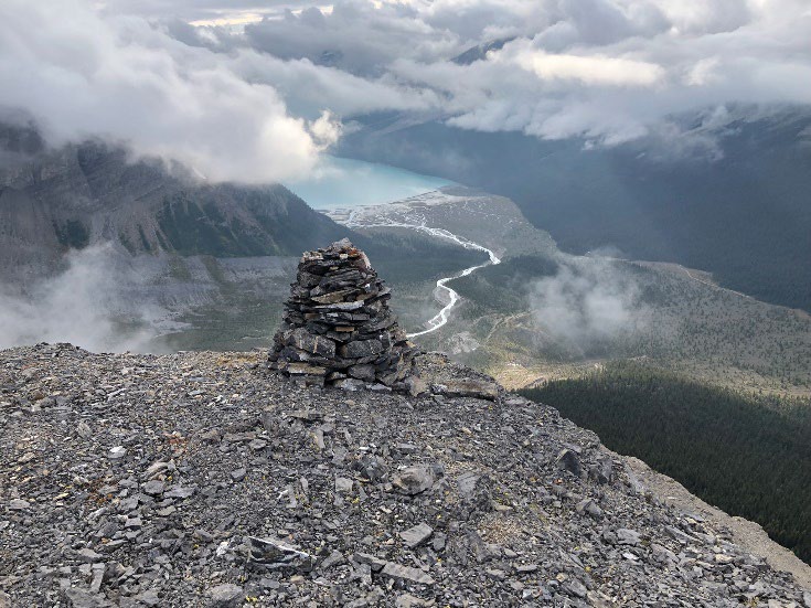
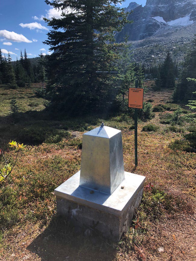
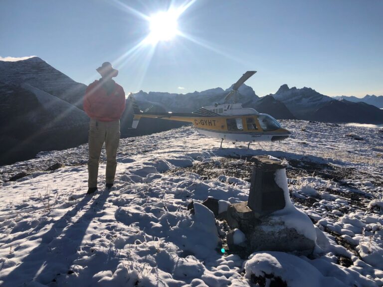
In particular, the Boundary Commission has developed a 30-year Boundary Maintenance Plan that systematically inspects and restores Alberta – British Columbia boundary monumentation for all those parts of the boundary that have been surveyed.
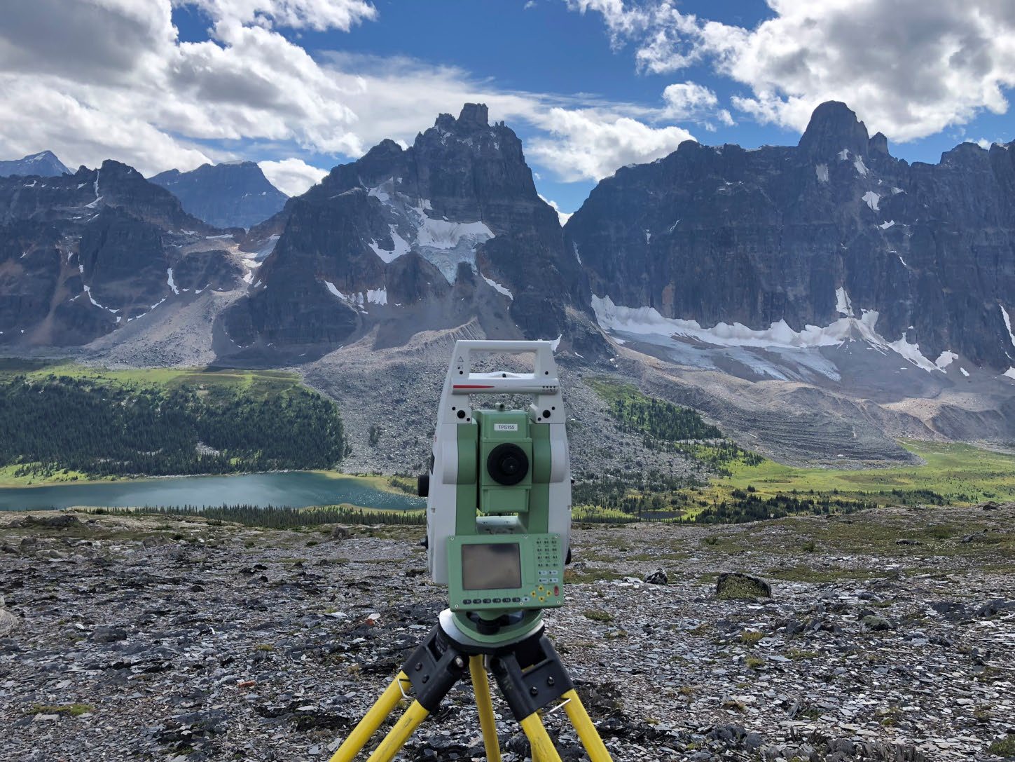
The Boundary Commission has developed a 30-year Boundary Maintenance Plan that systematically inspects and restores Alberta – British Columbia boundary monumentation.
The Alberta – British Columbia Boundary
The eastern boundary of British Columbia as of 1871 was the watershed of the Rocky Mountains from the international boundary to the 120th meridian, and then the 120th meridian to the 60th line of latitude. This boundary was formally defined in Sections 7 and 8 of the Imperial Act 29 and 30 Victoria, Chapter 67. Precise delimitation was not considered an urgent matter for many years after the Act was passed. For further information please see the Report of the Commission Appointed to Delimit the Boundary between the Provinces of Alberta and British Columbia. Part 1: 1913 to 1916; Chapter 1, Description of the Boundary as defined by Law and the Authority under which the Commission was Appointed. This report is available from the Provincial Boundary Commissioner Offices at the email addresses listed below.
History of the Boundary Commission
By 1913, the need to administer the use of coal deposits and forest reserves, to develop lines of communication between the two provinces and to better map the boundary became important. It was acknowledged at that time the “watershed is by no means so well defined on the ground as might be supposed”. As a result, the Federal government and provincial governments of the day agreed to survey the boundary with appointment of a representative from each government to form the Boundary Commission. The work of the Boundary Commission was carried out in three distinct phases to demarcate selected passes and parts of the boundary with monumentation.
 |
Phase 1 – 1913 to 1924
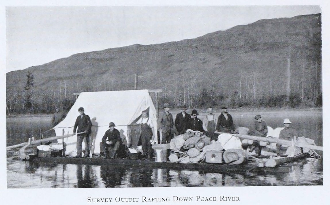
Canada, Alberta, and British Columbia agreed by orders in council to delimitate the boundary between the two provinces. Each jurisdiction appointed one Boundary Commissioner – J.N. Wallace, DLS for Canada, A.O. Wheeler, BCLS for British Columbia and R.W. Cautley, DLS ALS for Alberta. Each jurisdiction also bore one-third of the surveying costs.
In addition, the federal Minister of the Interior had observed in 1912 that the provisions of the British North America Act 1871 had to be complied with. This meant that any demarcated lines had to be accepted by the legislatures of the two provinces before the parliament of Canada could enact legislation declaring that line to be the boundary between the provinces.
Instructions were issued to the Boundary Commissioners on June 13, 1913 from the Surveyor General for Canada, on behalf of the three jurisdictions. Clause 4 is seminal; it set out that not the entire watershed boundary was to be demarcated:
“Where the watershed line is sharp and well defined, it shall be adopted, but where the land is flat and rolling and where there might be some doubt as to its position, it shall be defined by a series of straight lines running given distances on stated bearings in the general direction of the sinuous line of watershed and monuments shall be established at the points of deflection”. – Report of the Commission Appointed to Delimit the Boundary between the Provinces of Alberta and British Columbia. Part 1: 1913-1916. P8.
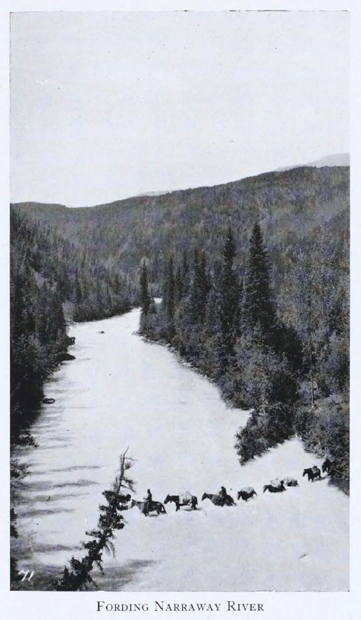
The Commissioners were instructed to focus on the 13 most significant passes owing to their proximity to mining and timber claims, to their use for highways and railways, and to their being close to populated areas. The Commissioners worked steadily over 12 years – from 1913 to 1924, demarcating rectilinear (conventional) boundaries in the passes and mapping the entire watershed boundary using both photo-topography and an extended system of triangulation. The conventional, demarcated boundaries served two purposes:
- Established an arbitrary boundary in the pass itself that “approximates the true position of the watershed”; and
- Provided a “carefully measured base for the system of triangles on which the work of the topographical section of the Commission depends…”.
Beyond the passes “the Boundary thus established [was] the natural watershed and [was] therefore not marked with monuments…”.
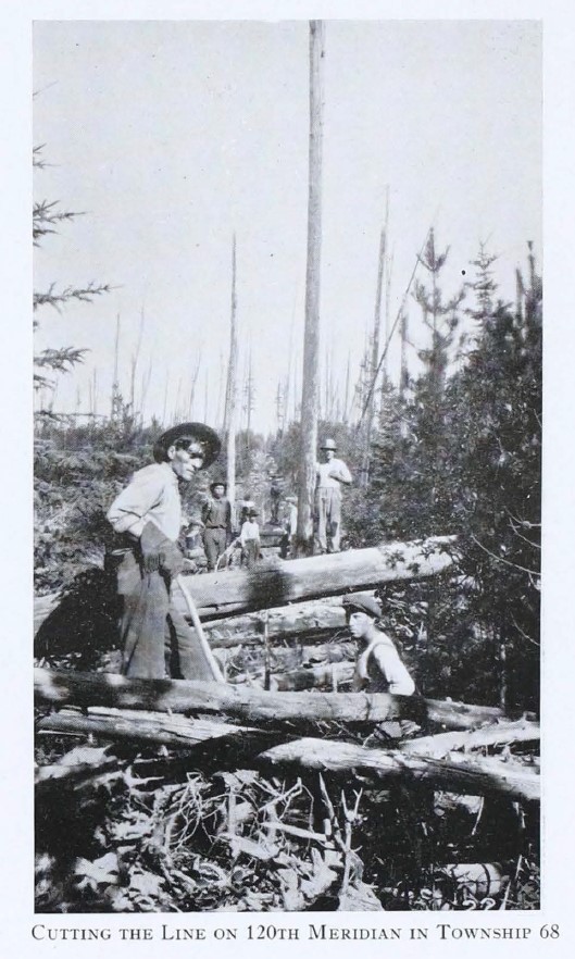
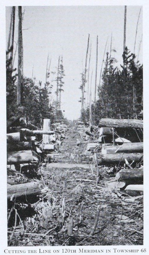
Over the 12 years, the Commission demarcated the boundaries in the passes, demarcated the 120th meridian to 57-26-39 dms North, and mapped the entire watershed boundary. The demarcated boundaries were assented to by Alberta and British Columbia in 1931, and confirmed by federal legislation – the Alberta-British Columbia Boundary Act, 1932.
Phase 2
After 1924 “there was no pressing necessity for continuation of the boundary survey”. However, by 1949 a survey of the boundary along the 120th meridian north of 57-26-39 dms was required owing to:
- Petroleum exploration; and
- Ground control to allow for the mapping of Alberta
Consequently, by orders in council in 1949 and 1950, Canada, Alberta and British Columbia agreed to each appoint a new Boundary Commissioner to survey the boundary north of 57-26-39 dms. Canada appointed B.W. Waugh, DLS, Alberta appointed J.H. Holloway, ALS and British Columbia appointed N.C. Stewart, BCLS; each jurisdiction also agreed to bear one-third of the survey costs.
The new Commission noted the significant differences between its work and the survey of the watershed in the 1913-1924 period. For the latter, “precise ground surveys were feasible only across the main passes, the intervening gaps being filled in for mapping purposes by means of photo-topographical operations”. However, the unsurveyed part of the 120th meridian boundary was characterized by:
- Its straightness and remoteness from larger centers of settlement;
- The comparatively level terrain through which it ran; and
- There being no dispute as to its position, which was the 120th meridian.
From 1950 to 1953, this part of the boundary was fully demarcated. The demarcated boundary was assented to by Alberta and British Columbia and confirmed by federal legislation – the Alberta-British Columbia Boundary Act, 1955.
The Commission concluded that maintenance of the monuments and of the cut line (along both the watershed and the meridian) was important: “It would be most unfortunate if this boundary line, representing a large capital outlay, were not properly preserved.” However, a legal opinion in 1955 was that once the boundary had been demarcated to the satisfaction of the three jurisdictions, then “the Canadian Government’s interest in the matter ceases” and the onus was on the two provinces to maintain the boundary.
 |
 |
Phase 3
In 1974, the three jurisdictions agreed that it was desirable to establish a new Boundary Commission, “with powers to resurvey the sinuous boundary line, settle disputes respecting the boundary and establish and maintain survey monuments and other physical evidence of the boundary”. Federal legislation established the Commission – the Alberta-British Columbia Boundary Act, 1974. The Act remains in force. Section 4 sets out the duties of the Commission:
- To resurvey the sinuous boundary line;
- To settle any boundary dispute that is referred to the Commission by holding at least one public hearing on the dispute; and
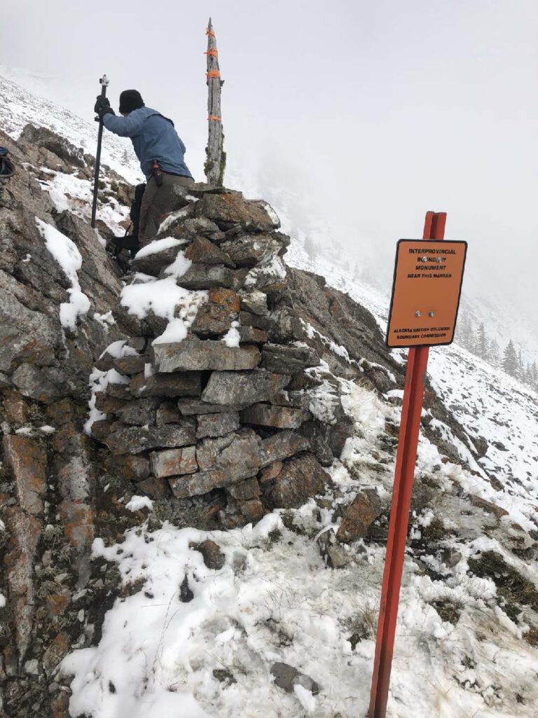
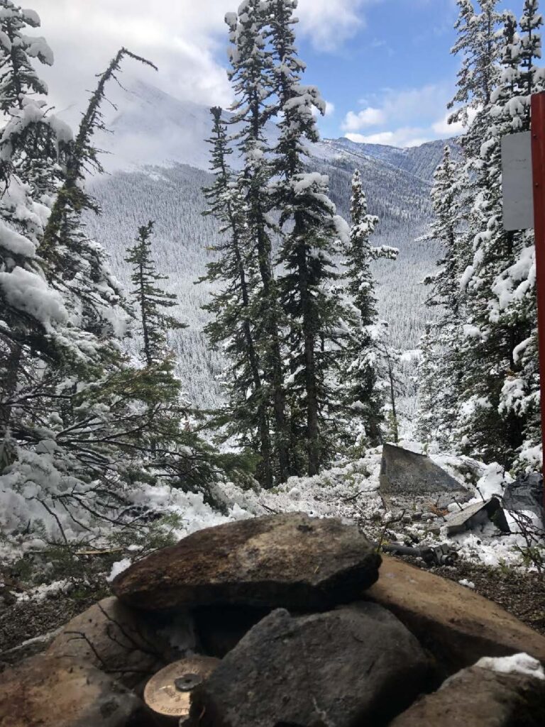
- To establish, restore and maintain survey monuments and other physical evidence of the boundary.
Further, the Constitution Act, 1982 sets out that any alteration to the boundaries of a province requires an amendment to the Constitution. The amendment may be made by a proclamation of the Governor General, but only if authorized by:
- Resolutions of the legislative assembly of each province to which the amendment applies; and
- Resolutions of the Senate and House of Commons.
The following are not alterations to the provincial boundary:
- Maintaining monuments;
- Maintaining cut lines; and
- Re-mapping the boundary.
The current Boundary Commission has been active since the early 1980’s and is comprised of the Surveyor General of Canada Lands, the Director of Surveys of Alberta, and the Surveyor General of British Columbia.
Contact the Boundary Commissioners
Further information regarding the Boundary Commission can be obtained by contacting one of the Boundary Commissioners. They can be contacted via the following email addresses:
 |
Alberta – DirectorofSurveys@gov.ab.ca British Columbia – Surveyor.General@ltsa.ca |
For information regarding relevant legislation for Alberta, British Columbia, and Canada please see the links below.
Useful Links
Alberta:
- Boundary Surveys Act (RSA 2000, Chapter B-5)
- Surveys Act (RSA 2000,Chapter S-26)
- Land Surveyors Act (RSA 2000, Chapter L-3)
- Referendum Act (RSA 2000, Chapter R-8.4)
British Columbia:
- Boundary Act [RSBC 1996] c. 32
- Land Survey Act [RSBC 1996] c. 247
- Land Surveyors Act [RSBC 1996] c. 248
- Constitutional Amendment Approval Act [RSBC 1996] c. 67
Canada:
-
 North Fork Pass / Col de North Fork
 -
 North Fork Pass Restoration / Restauration du col de North Fork
 -
 Tonquin Pass Restoration / Restauration du col de Tonquin
 -
 Miette Pass and Robson Pass Monument Inspection Surveys