Disaster Recovery Information
Contents
LTSA’s and Land Surveyors Roles in Disaster Response
The Surveyor General is responsible for maintaining the integrity of the Province’s cadastral survey system by ensuring that the actual ‘on the ground’ extent of parcels of land and interests in land are delineated in high-quality surveys. When a part of the Province is affected by a disaster, the survey monuments used to mark property boundaries in the area may also be affected. After a disaster, BC land surveyors work with landowners and local governments to support the restoration of the cadastral survey system following existing legislation, common law and required standards. The Surveyor General can provide advice to land surveyors and help coordinate a consistent, situation-specific response.
What is the Cadastral Survey System?
The cadastral survey system is the combination of physical survey evidence, records, policies, and regulations used to define property boundaries and support the registration of lands. The physical elements of the cadastral survey system include the survey monuments and geodetic control monuments used to mark, reference, and define property boundaries.
To define a property boundary land surveyors will place survey monuments in the form of iron posts, lead plugs, and capped posts (among other types) at boundary corners, or at locations that can be used to reference boundary corners. The placement of survey monuments vary depending on the needs of the particular survey.
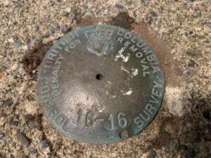
Geodetic control monuments are also used to reference property surveys to geographic coordinates needed for mapping and GIS. These control monuments are typically capped posts that have been installed by municipalities, the provincial, or federal government, in roadways and sidewalks across the province with precise geographic coordinates registered to them.
The Impact of a Compromised Cadastral Survey System
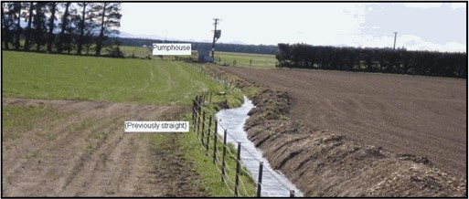
This physical survey evidence can be vulnerable to the effects of a disaster, and is particularly vulnerable in the recovery period when survey and control monuments are at risk of being destroyed through land clearing and other recovery activities where heavy machinery is involved. Some of the typical property boundary evidence, such as fences, hedges, and buildings can also be damaged or destroyed in a disaster.
The loss of survey evidence directly impacts land owners by making it more difficult to distinguish property extents, and may lead to confusion or misunderstanding on the true location of property boundaries. If left unresolved, unclear property boundaries can lead to issues such as property encroachment or new construction falling outside of bylaw setbacks.
This happened after the Fort McMurray wildfire disaster of 2016. In the recovery period, much survey evidence was destroyed, making it difficult to ascertain the extent of property boundaries. Some land owners were granted building permits without conducting proper legal surveys and were later found to be encroaching or otherwise not meeting municipal setbacks.
Importance of the Cadastral Survey System in Disaster Recovery
The cadastral survey system plays a crucial role in the rebuilding process after a disaster. Municipalities need a clear understanding of the extent of property boundaries in order to approve the development applications that will be necessary to rebuild after a disaster. Clearly defined property boundaries are an important part in any development process and will be particularly important in the substantial redevelopment that will need to take place after a disaster.
This means that property owners, municipalities, and the Provincial government all have an interest in protecting survey evidence to the extent possible in the aftermath of a disaster.
LTSA’s Involvement in Disaster Recovery
After a disaster, the Surveyor General may engage with local land surveyors in the area to:
- get an understanding of the situation and the state of the cadastral survey system in the area;
- encourage a consistent approach by all land surveyors working in an area, reducing duplication of effort and potential for conflicting boundary resolution;
- keep them apprised of any decisions by local government toward conducting larger-scale surveys in the area; and
- keep them apprised of any work the provincial government is doing in response to the disaster that may be useful for land surveying (e.g. updating mapping, drone imagery, etc.)
Land surveyors are welcome to contact the Surveyor General at any time to seek advice related to post-disaster surveys.
The Surveyor General may engage with local governments affected by the disaster to:
- convey the importance of requiring legal surveys as a part of redevelopment in the recovery period;
- advocate for the protection of survey evidence in the cleanup process;
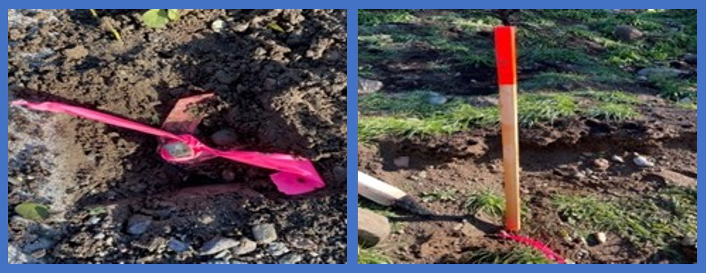
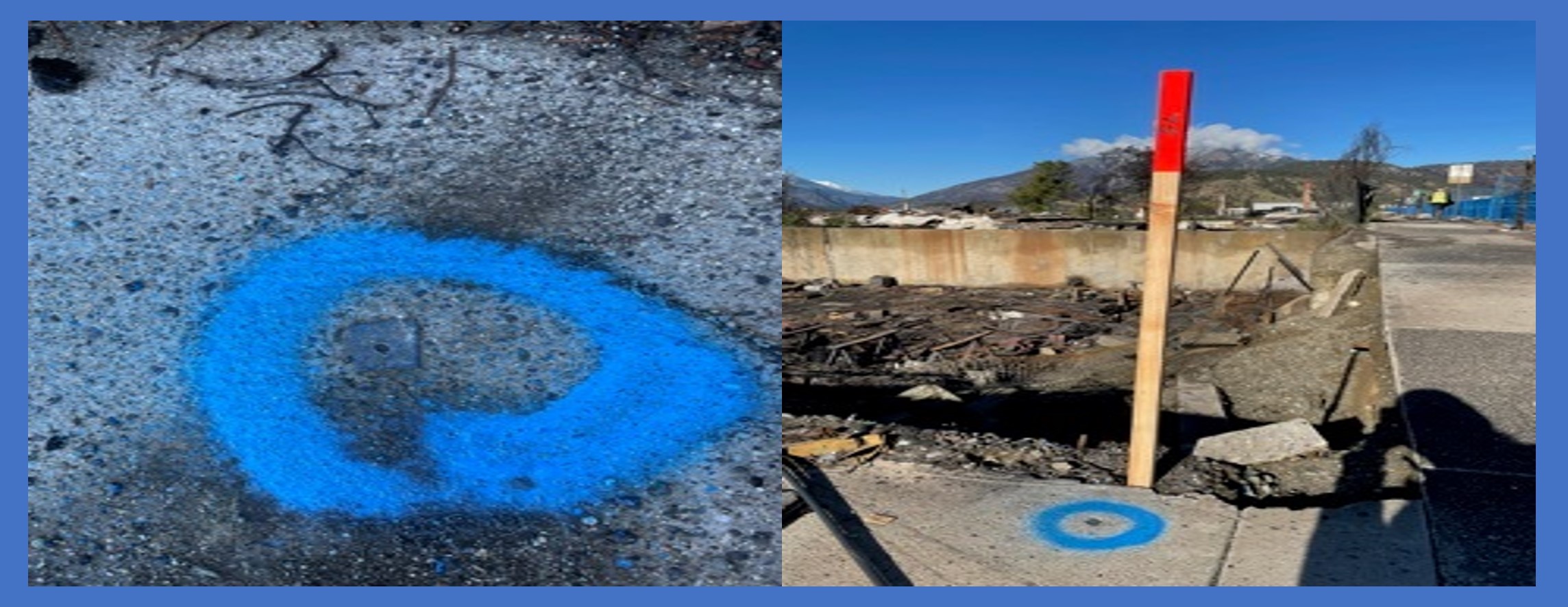
- potentially recommend and help facilitate a survey to be conducted prior to clean-up to:
- tie in the survey evidence to a control network;
- mark the evidence so that crews can try to protect it where possible; and
- record measurements to the survey evidence on a registered plan.
This approach was used in Lytton and resulted in easier, less costly surveys after clean-up and certainty for land owners.
- inform the local government on options available to them for larger-scale re-surveys;
The Surveyor General will engage with the provincial government to communicate survey initiatives that are taking place and to understand the provincial response.
Property Owners’ Role toward the Cadastral Survey System after a Disaster
After a disaster, property owners in the affected area should consult with a land surveyor before rebuilding or developing property. Surveyors will have up-to-date knowledge on any guidance issued by the Surveyor General, will be informed of the local government’s intentions toward larger-scale survey efforts, and will be able to accurately locate property boundaries so that property owners can begin to rebuild with confidence.
Local Government’s Role toward the Cadastral Survey System after a Disaster
Local Governments affected by a disaster may contact the Surveyor General or a local land surveyor to discuss options for protecting survey monuments and whether it makes sense to conduct a survey of the area before ground clearing and other cleanup takes place.
The Surveyor General can also discuss options for the surveys that may need to take place during the recovery process, including larger-scale surveys or replotting.
Finally, local governments will be encouraged to require a new legal survey from land owners before approving redevelopment in order to ensure that encroachment doesn’t become an issue during the recovery.
Earthquake Response
Earthquakes have the potential to affect the cadastral survey system differently than other disasters because of the ground movement that will occur during the earthquake.
After a significant earthquake, it may not be possible to address the changes to the cadastral fabric with regular survey practices. For example, typical surveying practice in BC requires a disturbed survey monument to be re-set in its original location; this may not be possible or practical if an earthquake has shifted the land significantly so that infrastructure, houses, and other improvements have also moved, and no longer align with the original property boundaries. Instead, it may be in the public interest to accept the moved position of property boundaries after an earthquake so that conflicts with infrastructure and improvements are minimized.
The approach of recognizing boundaries in their moved position after an earthquake is called the “boundaries-moved principle.”
- This principle was used with success (and after much consideration) in New Zealand in the aftermath of their devastating Christchurch earthquakes in 2010.
- Enabling legislation is required to utilize the boundaries-moved principle in BC.
The boundaries-moved principle would not be applied automatically after a major earthquake; it would depend on the real-world outcomes of a particular earthquake. The decision to implement the boundaries-moved principle would need to be made after understanding the impacts of a particular earthquake.