

As part of LTSA’s ongoing commitment to providing quality service, enhancements to ParcelMap BC New includes improved survey features and controls; added Plan-related and Related parcel actions; search improvements; and, file prefix adjustments. Certain specialized features available only to land surveyors.
Highlights include:
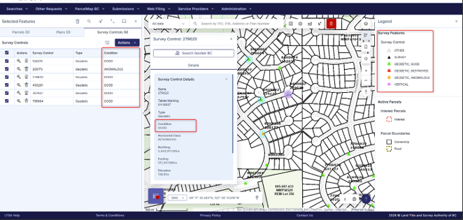
- Survey Control Information. Added a new Condition field to Survey Control records, providing additional information directly within Feature Details and the Selected Table.
- Survey Feature Labels. Improved Survey Feature and Survey Control labels in the Legend for easier identification and interpretation.
- Survey Symbology. Updated to align with the latest GEONET standards.
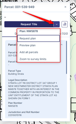
- Plan Actions. Added Plan-related actions directly within Parcel Feature Details, making it easier to preview and access related survey plans.
- Related Parcels Access. Added a Related Parcels action within Parcel Feature Details to simplify investigation of associated parcels.
- Search. Improved Plan Number search accuracy and AutoComplete behavior, and Legal Description searches.
- File Prefix. Addressed the numeric limitation on the file naming convention.
- Enhanced Mobile Experience. Coming soon, improved usability of map panels and parcel information and other workflows on tablets and mobile devices.
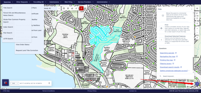
- Help Resources. Located in the lower right hand corner, click on the “?” button for keyboard short cuts and quick links to help resources. Visit System Help for additional support.
With changes based on customer feedback, these and future updates aim to deliver a modernized and streamlined online experience as customers transition to ParcelMap BC New ahead of the retirement of ParcelMap BC Classic this fall.
ParcelMap BC New – Help resources
ParcelMap BC New – Improved survey features and controls
ParcelMap BC New – Added Plan-related and Related parcel actions