Surveyor General’s October 2022 Report
Surveyor General Fall Report to ABCLS
October 2022
I’ve recently had the pleasure of attending Town Hall sessions put on by the Association of BC Land Surveyors in 5 regions of the Province, as well as a virtual Town Hall. It was great to see so many colleagues and I appreciate the level of engagement. The following report generally covers matters that were included in my report at the Town Hall session, providing an update on various Land Title and Survey Authority (LTSA) operational items and projects.
LTSA had a very busy start to this year, particularly in land title transaction volumes. Last year we processed over 33% more transactions than our historic norms. Not surprisingly the exceptionally strong volumes are now starting to reduce, reflecting the changes we’re seeing in the real estate market.
The number of plans received are showing some reductions with a 6% decrease in the first quarter (April through June), compared to last year and a 7% decrease in the second quarter. I don’t suspect that the number of plan submissions will drop as quickly as other land title transactions.
First quarter revenue for LTSA was 6% below last year’s Q1, but still our 3rd highest quarterly revenue ever, and total revenue for LTSA so far this year (at the end of September) is down approximately 7% compared to last year.
LTSA recently announced that we are hiring a Vice President and Chief Information Officer to lead a new technology division. This role will be responsible for critical information systems and cybersecurity strategies that enable LTSA to maintain, protect, and innovate core business activities. The Corporate IT and Research & Development departments will report to this new role.
LTSA’s business plan was published in April and strategic priorities remain the same for this fiscal year. The strategy includes continually focusing on improving operational excellence; developing innovative solutions in the public interest; reinvesting and strengthening core systems; and continual investment in people and capabilities.
Surveyor General Operations and Policy
For Surveyor General plan submissions, the volumes remain low compared to historic volumes, primarily due to sustained reduction in oil and gas related plans. Volumes have remained steady for statutory applications.
In addition, Deputy Surveyor Generals Dave, Katie and Chris continue to support the survey of lands associated with various First Nation agreements with the issuance of survey instructions and review of final plans.
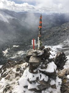
For the Alberta-BC Boundary Commission, we currently have three surveys underway.
- At Tonquin Pass, southwest of Jasper, 7 monuments are being restored and a total of 10 monuments are being georeferenced;
- At North Fork Pass, southeast of Elkford, 7 monuments are being restored and georeferenced; and
- The third is an inspection survey of 17 monuments along Miette Pass and Robson Pass, northwest of Jasper.
I’m looking forward to seeing the final reports for these three surveys.
Dave recently published an article through the ABCLS bi-weekly communication that provides information on several volumes of historical records in the custody of the Province that have recently been digitized and made available through Tantalis GATOR. This includes scanned reference maps that were traditionally used by SG and Lands staff to record and track information relating to parcels, tenures and surveys throughout the province. These maps contain references to plan and field book numbers that can be used as a tool for research. This can be useful for finding field notes that aren’t specific to individual parcels, such as surveys along shorelines.
Section 58 Land Act Applications have been a significant topic of conversation in our office this year.
In January I announced via Circular Letter that applications resulting in a transfer of Crown land require First Nation consultation. The Provincial government is undertaking this consultation on behalf of our office. We’ve asked that land surveyors clearly state in their application whether they are seeking a clarification of existing ownership or a transfer of land from Crown to private ownership.
I’ve also just recently sent out an additional communication relating to section 58 applications. We are clarifying that a s.58 certificate can only be endorsed on a subdivision plan and cannot be endorsed on a s.100(1)(a) reference plan. This is because the language in the Act clearly specifies ‘subdivision’.
ParcelMap BC
The Province has started a phased retirement of the Integrated Cadastral Fabric, or ICF, and is now relying on ParcelMap BC as the authoritative cadastral fabric. As of early July the ICF layers are now reflecting PMBC data. The next phases of the retirement will be disabling the public viewer and then the government viewer for the ICF.
The ParcelMap BC team continues to prioritize spatial improvements, often in collaboration with municipalities. The assessed accuracy of the fabric and targeted improvement areas can be viewed through the ParcelMap BC Spatial Improvement App on LTSA’s website.
In addition, the ParcelMap BC team has now integrated approximately 28,000 of 32,000 road parcels with active PIDs for the Titled Roads Project. The remaining titles are the most challenging to integrate.
They have maintained an impressive sub-1 day turn-around on dataset integration. Thank you to all surveyors for submitting your datasets prior to plan registration and for addressing any corrections to those datasets quickly.
Integrated Survey Area Project
We have concluded our consultation with the 52 Integrated Survey Area municipalities and received 3 requests for annulment, 2 deferrals, and 47 commitments. Those municipalities who have committed to the ISA Program have committed to ensuring an adequate density of control monuments in their ISA, periodic inspection of their control monuments, and to reviewing/implementing internal practices which could assist in the protection of control monuments.
Survey Plan Services Modernization Project
The survey plan services modernization project is progressing. The new workspace, called SurveyHub, will be accessible through myLTSA, for the assembly, validation, certification and submission of plans and associated data.
The target launch date of SurveyHub has not yet been set. The initial phase will focus on the alignment of survey plan and dataset with a move away from PDF forms to web forms.
A multi-step roll-out, with phased releases for the various plan types, will be used to ensure a smooth transition and allow land surveyors time to adopt new workflows for the final plan stages. We will be offering training as part of the roll-out.
First Nation National Land Registry Project
LTSA continues to work with the Lands Advisory Board as a technology partner and providing support for the First Nations National Land Registry project. The vision is to establish a shared, comprehensive, trusted, sustainable and First Nations governed land registry for lands governed under a Land Code or self-government arrangement.
Currently the project is at the solution definition stage and seeking Government of Canada funding approvals.
Post-Quake Boundary Restoration Project
The Surveyor General team is continuing to develop guidance related to re-establishing boundaries following a significant earthquake, based on boundaries-moved principles. This envisions that survey evidence and occupation may move in both an absolute and relative position and boundary dimensions after an earthquake may be different than before. In June, Tobin , Policy & Program Analyst, led another session with land surveyors to seek feedback on the guidance developed so far. Recently we’ve been focusing on determining any challenges with registering plans after an earthquake considering that boundary dimensions may no longer be consistent with underlying plans.
Lytton – Boundary Re-establishment
At the AGM I reported on the work already undertaken within the community of Lytton to assist with re-establishment of property boundaries for re-building, following the 2021 fire. Posting Plan EPP113011 records evidence tied prior to clean-up activities. In addition, the municipality is planning to have additional survey work completed this fall which will re-set some of the key property corners, such as block corners, to assist in future surveys. This will aid in the consistency of boundary re-establishment and reduce costs for individual land owners. This survey can’t be undertaken until after clean-up activities are finished. If you are engaged to conduct a survey within the municipality in the meantime, I would encourage you to contact our office to discuss.
CGVD2013 Vertical Datum Adoption Update
Over the past year, Peter has been involved with a GeoBC led working group related to the adoption of CGVD2013 as BC’s official vertical datum. There are inaccuracies and inefficiencies of using the current CGVD28 levelling based datum in a modern GNSS survey enabled world.
The delay in adopting CGVD2013 is related to difficulties in arriving at an alignment, within acceptable accuracy, of all geodetic infrastructure throughout BC with the new datum.
We’ve attended monthly meetings of all affected stakeholders. The committee has proposed a path forward to allow the provincial adoption to proceed. In order for the published values of the many thousands of physical benchmarks throughout the province to be compatible with the modern use of GNSS and the geoid model based datum, a significant amount of field and office work is necessary. CGVD2013 will likely not be adopted in BC for a few more years.
This fall, GeoBC and LTSA will be working together to run a pilot project on Vancouver Island. This project will involve obtaining GNSS data on targeted MASCOT monuments, focusing on select ISAs and highways, to derive accurate CGVD2013 heights. The pilot project will help inform a Province-wide project, allowing us to confirm the density of monuments that need to be surveyed and the approximate cost per monument.
It will be very beneficial for all provinces to adopt the modern geoid based vertical datum for interoperability between federal and provincial jurisdictions. Currently BC is not in alignment with the official federal vertical datum.
At this time, for legal surveys which require elevations, plans must continue to be referenced to CGVD28. For work where no plan is submitted to a registry, such as topo plans or layout for engineering projects, land surveyors may need to reference their heights to CGVD2013, depending on the needs of the client.
The existence of two vertical datums in BC has the potential to create confusion. Depending on the location, there may be differences in heights exceeding 1 metre, although for most of BC the differences are less than 50cm. The magnitude of the difference for much of the province is only approximately known at this time.
The ABCLS Practice Advisory Department and LTSA have developed a practice advisory to raise awareness of the existence of the two vertical datums and to suggest some tips to help minimize errors due to the inadvertent mixing of vertical datums. This practice advisory is available on the ABCLS website.
In conclusion, I greatly appreciate the engagement of the land surveying community in our projects and thank you for continuing to guide improvements in LTSA’s services.